
The National Geographic Okavango Wilderness Project (NGOWP) is a key initiative of the Wild Bird Trust, in partnership with the National Geographic Society. Its mission is to explore and protect the Okavango River Basin, a vast and biodiverse ecosystem spanning Angola, Namibia, and Botswana. The project is dedicated to preserving this critical region, which supports the Okavango Delta, one of the largest freshwater wetlands in Southern Africa, and its rich diversity of wildlife. Through scientific research and collaboration with local communities and governments, the NGOWP aims to secure sustainable protection for this vital landscape.
The partnership focuses on the four most important conservation priorities on the African continent today: water security, carbon storage, wildlife corridors and biodiversity conservation.


The founding objective of the National Geographic Okavango Wilderness Project, a partnership between the Wild Bird Trust and the National Geographic Society, is to explore and survey the least-known, most inaccessible parts of the Okavango River Basin spanning the countries of Angola, Namibia and Botswana in Southern Africa.
The Okavango Delta, located in northern Botswana, is one of the largest freshwater wetlands in Southern Africa—and is home to over half of the remaining elephants on the planet, as well as populations of lions, leopards, wild dogs, buffaloes, giraffes, hippos, and rhinos.The Angolan HighlandsWater Tower, which begins in Angola, is the primary water source for the Okavango Delta. This region’s vast landscape of lakes, peatlands, miombo woodlands, and rivers provides sanctuary for a high concentration of biodiversity. Protecting this water tower—known by the Luchaze people as Lisima Iya Mwono, or “Source of Life” - is fundamental to the future of the Okavango, Kwando, and Zambezi rivers and the millions of people which depend on their water.
Donate Today
Become a champion for change. Any donation will help us to conserve our incredible wildlife heritage.
hydrological monitoring project
Since 2015 the NGOWP has systematically explored the major rivers that sustain the Okavango delta namely the Cuito, Cuanavale, Cubango and Cuando.
Since 2015 the National Geographic Okavango Wilderness Project has systematically explored the major rivers that sustain the Okavango delta namely the Cuito, Cuanavale, Cubango and Cuando. This entailed land-based expeditions to rediscover the river sources in the highlands of Angola followed by mekoro (traditional dugout canoes) expeditions all the way to the rivers’ ends whilst recording data on biodiversity, ecosystem health and socioeconomics. The team soon recognised the importance of what has now been termed the Okavango-Zambezi Water Tower, a giant pile of Kalahari sand rising to 1.8km with a footprint larger than Greece. Ample annual rainfall over this water tower percolates into the sand to be discharged slowly and consistently into the rivers that flow from it.


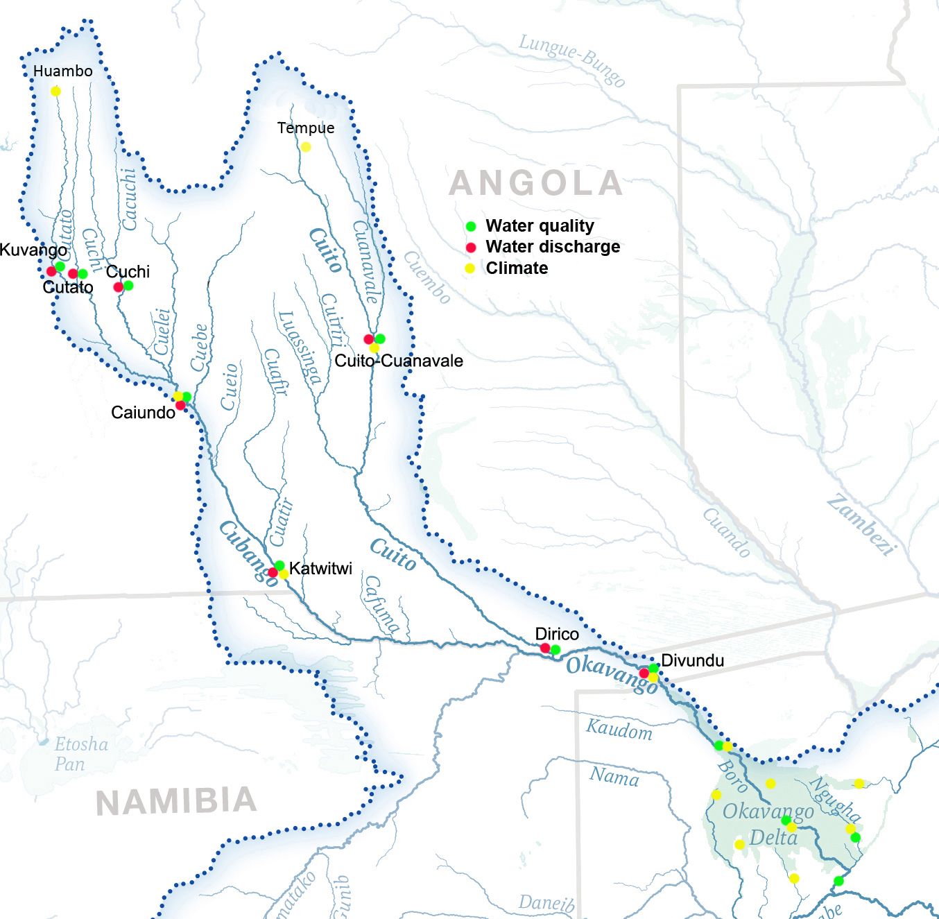
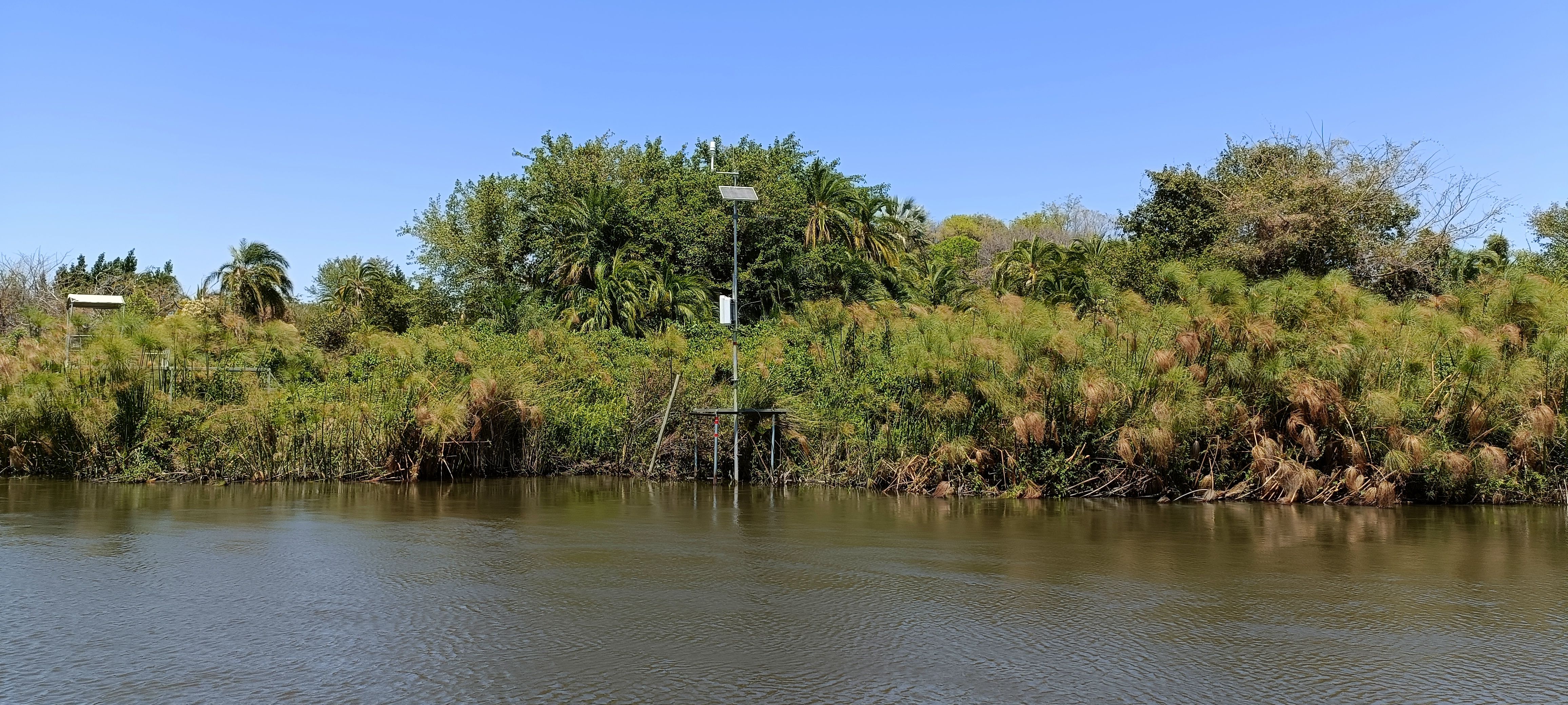
Through exhaustive consultation, workshops and symposiums with relevant stakeholders, experts and institutions, the National Geographic Okavango Wilderness Project and its partners devised a hydrological monitoring plan that records water discharge, water quality and climate at several strategic locations throughout the Okavango Basin. The Okavango delta would not exist without this steady recharge of water, yet in the face of economic development and climate change, water flows require careful monitoring in order to predict adverse changes in the hydrological functioning of these rivers – and ultimately the continued livelihoods of people and wildlife downstream..
the okavango experience
Since 2015 the NGOWP has systematically explored the major rivers that sustain the Okavango delta namely the Cuito, Cuanavale, Cubango and Cuando.
In 2018, three filmmakers joined the National Geographic Okavango Wilderness Project team in Botswana as they surveyed the wildlife and ecosystems on mekoro (local dug-out canoe) The video series was recorded by two cinematographers and an audio recordist who were in the Okavango with the National Geographic Okavango Wilderness Project team for three weeks. They used a Yi Halo VR camera, which has 17 cameras arranged in a circle, and they captured spatial sound, which is essentially 360-degree audio that moves with the video’s viewer. The outcome was a 4 part 360-degree video series, the “The Okavango Experience”.


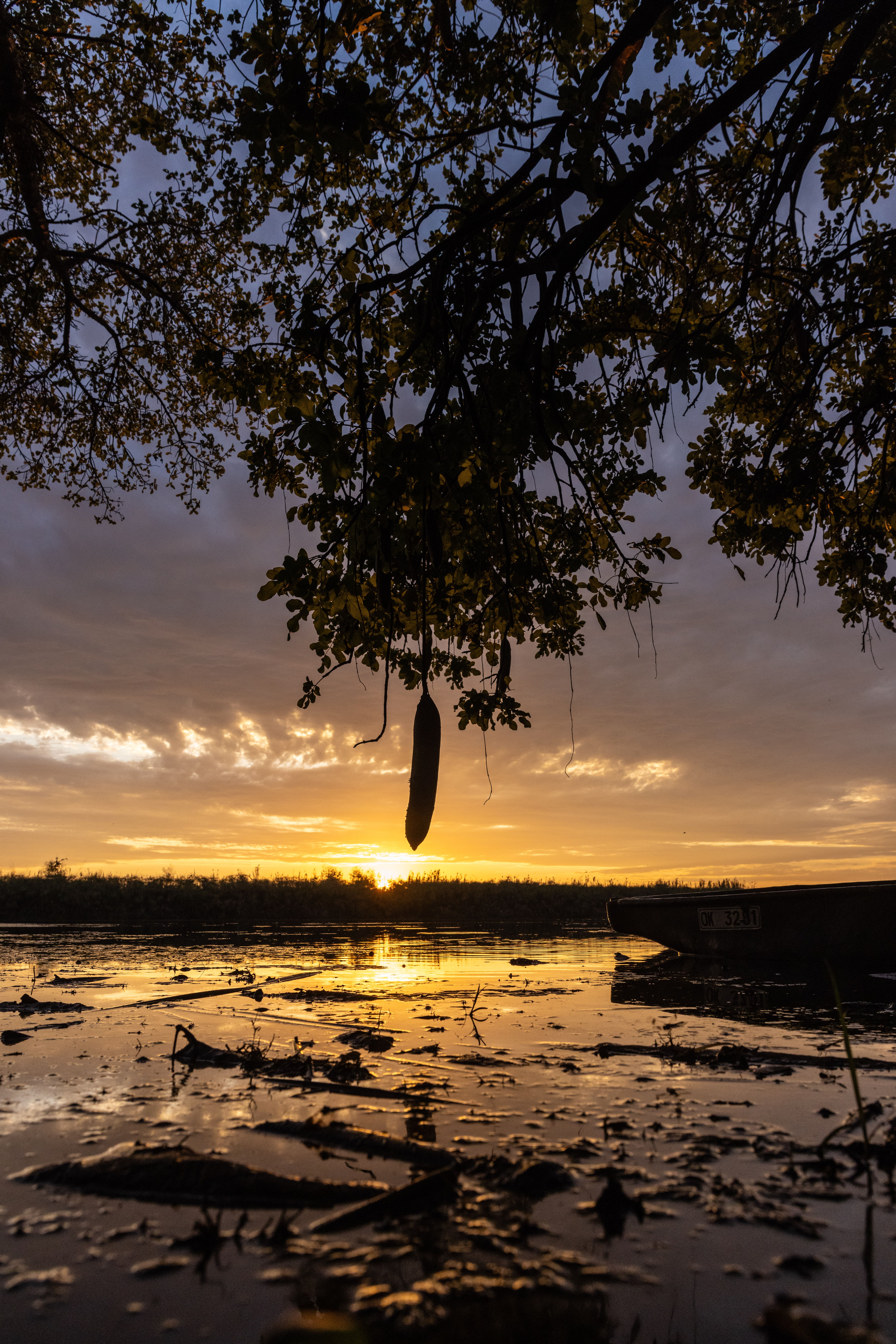
Immerse yourself as you venture through this wilderness and get very up close and personal with its most iconic creatures. Sit at the feet of an elephant as it passes by, glide through the channels on a mekoro while being watched by a hippo, listen to the local bird and frog sounds and enjoy the sun set over the grasslands as you sit beneath a 2,000-year-old baobab tree.
Introducing Okavango Explore. An interactive StoryMap that shows how Angola’s highlands feed the Okavango Delta, and the innovative research that’s being done to conserve the waterways, the ecosystems, and the human communities of this remarkable place. Journey with us down the river and see how the National Geographic's Okavango Wilderness Project is helping scientists better understand this landscape and educate the world about its wonders.
Introducing Okavango Explore. An interactive StoryMap that shows how Angola’s highlands feed the Okavango Delta, and the innovative research that’s being done to conserve the waterways, the ecosystems, and the human communities of this remarkable place. Journey with us down the river and see how the National Geographic's Okavango Wilderness Project is helping scientists better understand this landscape and educate the world about its wonders.
resources
Read about all the latest news, research and inspiring stories on The National Geographic Okavango Wilderness Project.
Kwando (2019) | Documentary | National Geographic Okavango Wilderness Project
Kwando (2019) tells the story of a young Angolan fisherman who joins a team of international scientists. The fisherman is haunted by his past as a child soldier and is uncertain about his future. The documentary explores the Okavango Basin is a natural water tower, composed of hundreds of streams that start in the Angolan plateau and provide trillions of litres of water to the famous rivers of the African continent. The Okavango Delta in northwestern Botswana, one of the last untouched wilderness regions in Africa, and its importance for both wildlife and the local economy. It is home to a rich biodiversity, including the world's largest population of elephants. The documentary also delves into the challenges of navigating the Kwando River, known for its floodplains and the potential presence of landmines left over from the civil war in Angola. The team of scientists and local guides conduct various surveys, including animal sightings, fish and reptile collection, and water quality tests. They aim to understand this unique and fragile ecosystem to help future generations. The documentary also touches on the impact of war on both humans and wildlife, as well as the importance of conservation efforts for the survival of this ecosystem.
Join our flock
Subscribe to our newsletter to receive exciting news about our projects.
We care about the protection of your data. Read our Privacy Policy.